NEXT Plantation Management System – NPMS
The world without agriculture is zero-life on planet earth. Agriculture is essential for every human yet less catered with technological augmentation. Technology and data-driven approach is the future for almost many stakeholders in agriculture. Plantation attracts long term and hefty investments. Hence budgeting and planning activities become very crucial for a flourishing plantation. Various management modules are prime parameters for profitability. NEXT PLANTATION MANAGEMENT SYSTEM (NPMS) establishes entire control over key parameters. NPMS is the most advanced and comprehensive plantation management system which backs entire business for any size plantations. It simplifies plantation management. In case of absences of Plantation management system, these problems might put your process to the screeching halt.
- Poor farming techniques
- Fewer improvements have been made to ensure the safety and gain of crops
- Non-availability of quality seeds
- Farm survey procedure is more
- Farm monitoring and management is difficult
- Farm data mapping
- Insufficient monitoring and management tools
- Uneducated about plant disease based on weather conditions
- Less agriculture professionalism
- Less integration of GIS technology
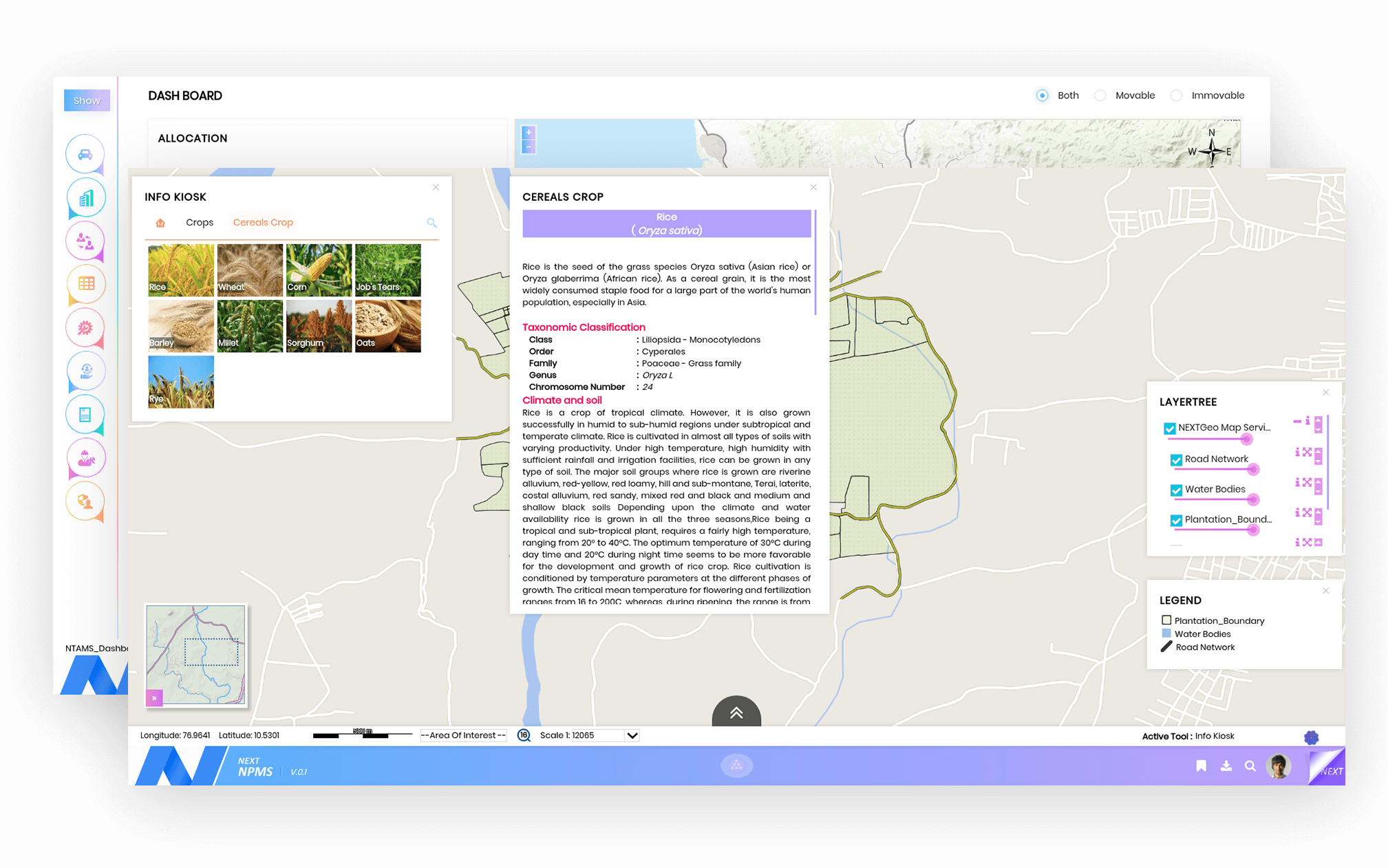
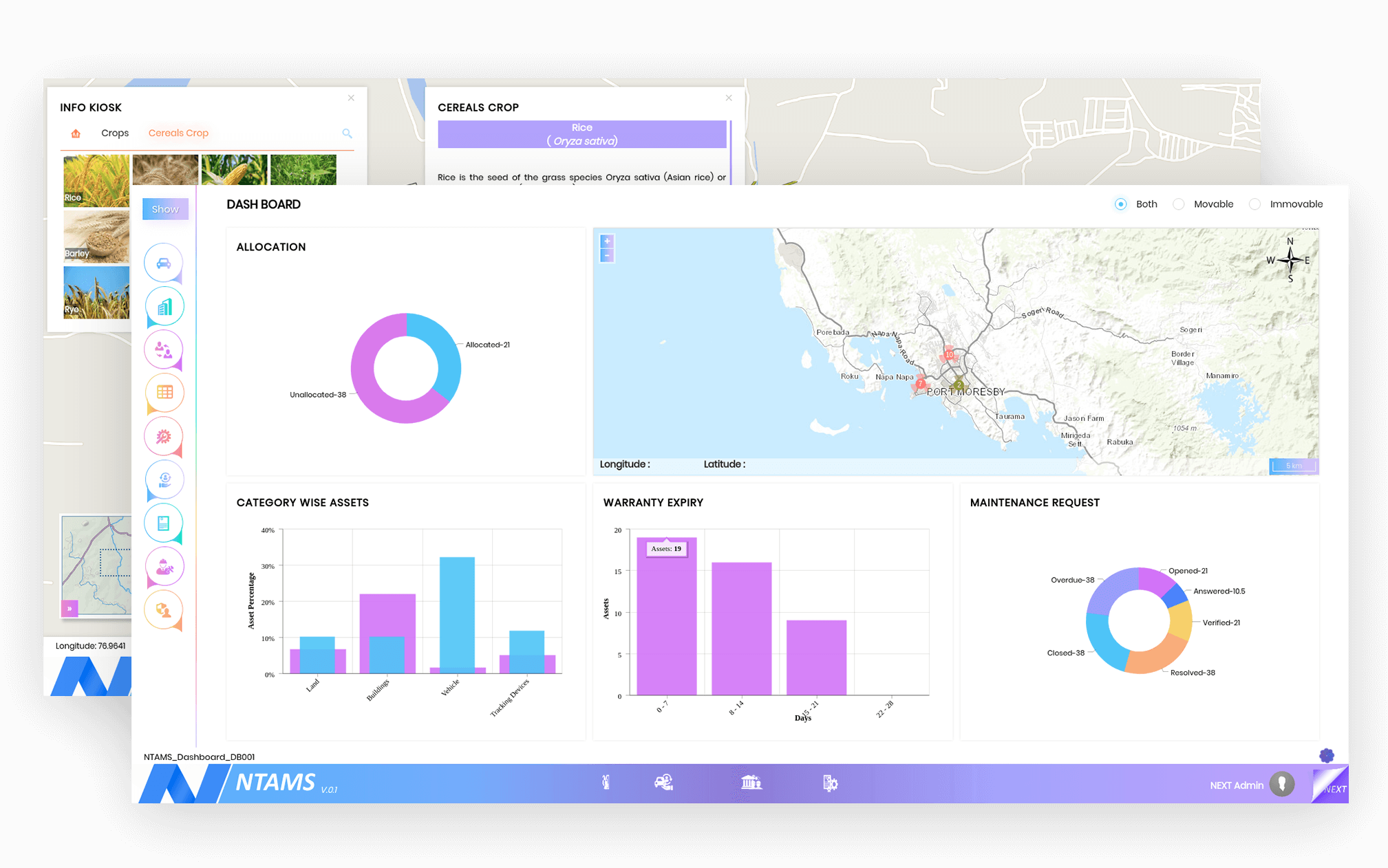
Our NEXT Plantation Management System (NPMS) is based on GIS which handles the overall plantation operations from the acquisition of land, land improvements, planting, maintenance, harvesting, and payroll until replanting. All activity controlled through the system resulting in efficiency and productivity, with business intelligence analysis that can help Management in controlling and accurate decision making.
NPMS Features
- Farm mapping
- Productivity estimation
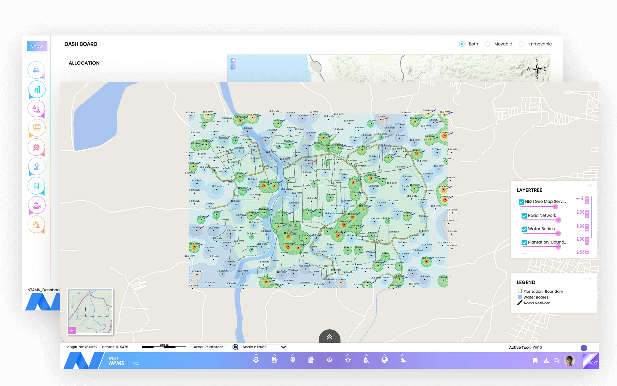
- Spatial Intelligence
- Farm measurement through GIS technology
- Secured data access
- Farmer self –information system
- Reporting and notification system
- Databank and historical information of Farm

Farmer & Farm Self Information System (Data Management)
Agricultural development profoundly helps in industrialization and thus significant progress is evident. So all information with regards to the farmers and farm information should be captured and retrieved accurately. The Farmer and Farm Enrolment module encompass in capturing the information directly from farmers and Captures the profile of the plantation areas and crop details along with farmer’s details.

Spatial Intelligence
Agriculture aids in producing raw materials which require other industrial support as well. So we need to have visual information handy. Spatial Intelligence is the ability to process visual information which deals with the farmer can identify or find nearby seeds shops, fertilizer shops, Selling dealer shops, machinery equipment shops from their location.

Digital Farm Mapping
When agricultural development is the main focus, it will naturally uplift process. So the farm in-charge should be well versed about land. Digital Farm Mapping is a farming management concept based on observing, measuring and responding to inter and intra-field variability in crops. It returns on inputs while preserving resources. It deals with infrastructure along with the properties and whether forecasting which is included in a particular farm.

Farm Cultivation /Farmer Details
Primary goods that are required by the industries are obtained by agriculture. So in agriculture, there is no specific routine process. It changes accordingly. Each and every detail has to be recorded and monitored. It leverages to know the entire cultivation (farm type, cultivation plant, soil type, irrigation type, etc..,) details of particular farm and also provide the farmer details of that farm.

Advisory Services
The advisory services bestow the Insurance document for drought, flood, etc.., Farmer can fill this application and send it to Agriculture management office to claim money for cultivation. And also provide the information about Farm cultivation, weather forecasting and inquiry about cultivation, farming (a forum for agriculture discussion) and, etc..,.

Farm Surveying
Our farm surveying module alleviate in measuring and mapping out the position, height, size, and boundary of an area of farmland.


